- File
- File history
- File usage
- Canada relief map 2.svg (Download file)
- Metadata
Original file (SVG file, nominally 1,114 × 942 pixels, file size: 1.47 MB)
This file is from Wikimedia Commons and may be used by other projects. The description on its file description page there is shown below.
Summary
| DescriptionCanada relief map 2.svg | |
| Date | |
| Source |
Own work.
|
| Author | MapGrid |
| Other versions |
|
| SVG development InfoField |
Map Info
| Projection: | Lambert conformal conic |
|---|---|
| Datum: | WGS84 |
| Central Meridian: | 95.000000°W |
| Latitude of Origin: | 60.000000°N |
| Standard Parallel #1: | 49.000000°N |
| Standard Parallel #2: | 77.000000°N |
| x (%)= | 201.7818903*(((tan(pi*(90-$1)/360))*(((1+0.08181919084*sin(pi*$1/180))/(1-0.08181919084*sin(pi*$1/180)))^0.04090959542))^0.9007900864)*sin(0.01572175288*($2+95))+43.98563734
|
|---|---|
| y (%)= | 238.6252927*(((tan(pi*(90-$1)/360))*(((1+0.08181919084*sin(pi*$1/180))/(1-0.08181919084*sin(pi*$1/180)))^0.04090959542))^0.9007900864)*cos(0.01572175288*($2+95))-15.81495465
|
| $1: | latitude in degrees (positive for all locations in Canada). |
| $2: | longitude in degrees (negative for all locations in Canada). |
| x (%): | x coordinate expressed as percentage of image width (measured from left edge). |
| y (%): | y coordinate expressed as percentage of image height (measured from top edge). |
| x (px) | y (px) | x (%) | y (%) | Latitude | Longitude | |
|---|---|---|---|---|---|---|
| Top Left Corner: | 0.000 | 0.000 | 0.00 | 0.00 | 68.220310°N | 176.138684°W |
| Top Right Corner: | 1114.000 | 0.000 | 100.00 | 0.00 | 62.238635°N | 9.994317°W |
| Bottom Right Corner: | 1114.000 | 942.000 | 100.00 | 100.00 | 34.831244°N | 61.953430°W |
| Bottom Left Corner: | 0.000 | 942.000 | 0.00 | 100.00 | 37.392537°N | 121.850536°W |
| Centre: | 557.000 | 471.000 | 50.00 | 50.00 | 63.068962°N | 88.152750°W |
| Origin: | 490.000 | 541.000 | 43.99 | 57.43 | 60.000000°N | 95.000000°W |
| North Pole: | 490.000 | -148.977 | 43.99 | -15.81 | 90.000000°N | ⸻ |
| Thechàl Dhâl: | 67.523 | 368.241 | 6.06 | 39.09 | 61.022873°N | 138.564925°W |
-R-121.85053574/37.39253661/-9.99431686/62.23863537r -JL-95.00000000/60.00000000/49.00000000/77.00000000/29.70666667i |
Licensing
I, the copyright holder of this work, hereby publish it under the following license:
This file is licensed under the Creative Commons Attribution-Share Alike 4.0 International license.
- You are free:
- to share – to copy, distribute and transmit the work
- to remix – to adapt the work
- Under the following conditions:
- attribution – You must give appropriate credit, provide a link to the license, and indicate if changes were made. You may do so in any reasonable manner, but not in any way that suggests the licensor endorses you or your use.
- share alike – If you remix, transform, or build upon the material, you must distribute your contributions under the same or compatible license as the original.
Captions
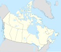
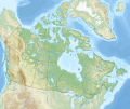
Physical (relief) map of Canada, with primary internal political boundary lines (i.e. provinces and territories).
15 November 2020
image/svg+xml
3ac1d2c5c5483dc57951be0761ea9d0b63f99208
1,540,948 byte
942 pixel
1,114 pixel
File history
Click on a date/time to view the file as it appeared at that time.
| Date/Time | Thumbnail | Dimensions | User | Comment | |
|---|---|---|---|---|---|
| current | 13:44, 29 December 2020 | 1,114 × 942 (1.47 MB) | wikimediacommons>MapGrid | added an international boundary line between Canada and St Pierre & Miquelon |
File usage
The following 3 pages use this file:
Metadata
This file contains additional information, probably added from the digital camera or scanner used to create or digitize it.
If the file has been modified from its original state, some details may not fully reflect the modified file.
| Short title | Canada Relief Map |
|---|---|
| Width | 1114 |
| Height | 942 |
Retrieved from "https://bahai.media/File:Canada_relief_map_2.svg"


